Randha Fm
Type Locality and Naming
OUTCROP. Outcrop near Randha village is considered type the area. The formation has also been encountered at Birsingha well. Dhar and Mehta (1974) mapped this formation in Kohra - Chimpasani- Math - Birmania Section and Randasar - Randha - Birsingha section. [Original Publication: Misra, J.S. and Shrivatsava, B.P. 1960 Progress report of party no. 10, Western Rajasthan, ONGC report (Unpublished)]
Synonyms: The Randha Formation was first mapped by Narayanan (1959) as a part of the Birmania Fm.
Lithology and Thickness
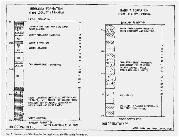
Sandstone. It is dominantly fine to coarse-grained, well-indurated thickly bedded, calcareous, quartzitic sandstone with shale intercalations. The lowest bed overlying the basement is represented by red to maroon, occasionally grey, very fissile shale whereas towards top sandy shales are present. Maximum thickness of the formation is around 200 m at type locality.
[Figure 1: Stratotype of Randha Formation, Mesozoic Lithostratigraphy of the Jaisalmer Basin, Rajasthan, Journal of the Paleontological Society of India, Vol. 51(2) (after Singh N.P, 2006)]
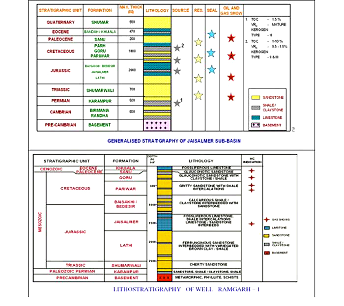
[Figure 2: Generalized and Subsurface Stratigraphy of Jaisalmer Basin (from dghindia.gov.in)]
Relationships and Distribution
Lower contact
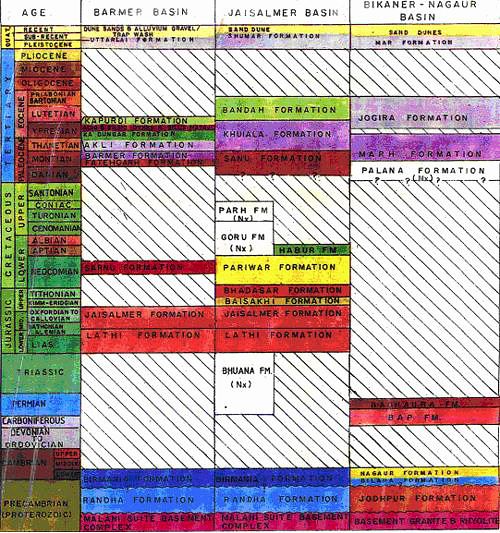
The lower contact of the formation is unconformable with the underlying basement complex (Rhyolite/Granite).
Upper contact
Cherty Red Clays indicating slight break in sedimentation represent the contact between Randha Fm and Birmania Fm. However, Muktinath (1969) has shown a faulted contact.
GeoJSON
Fossils
Age
Depositional setting
The lithological association of red shales, calcareous quartzitic sandstone and sandy shale is indicative of fluctuating environment ranging from continental to near shore.
Additional Information


